
Educational Map Series: Old Africa Collection
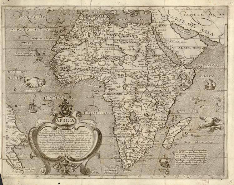
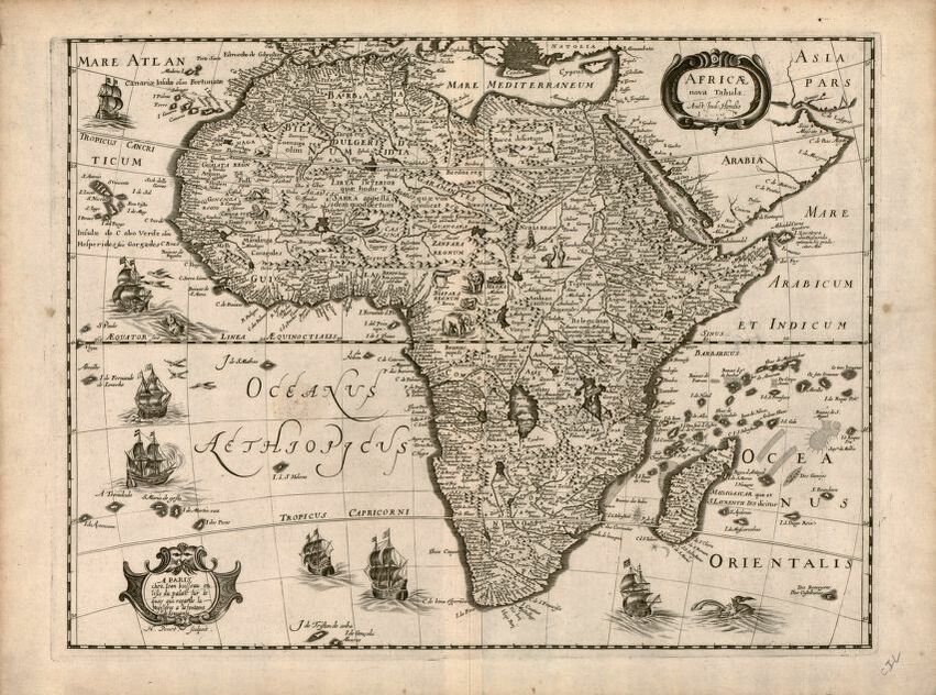
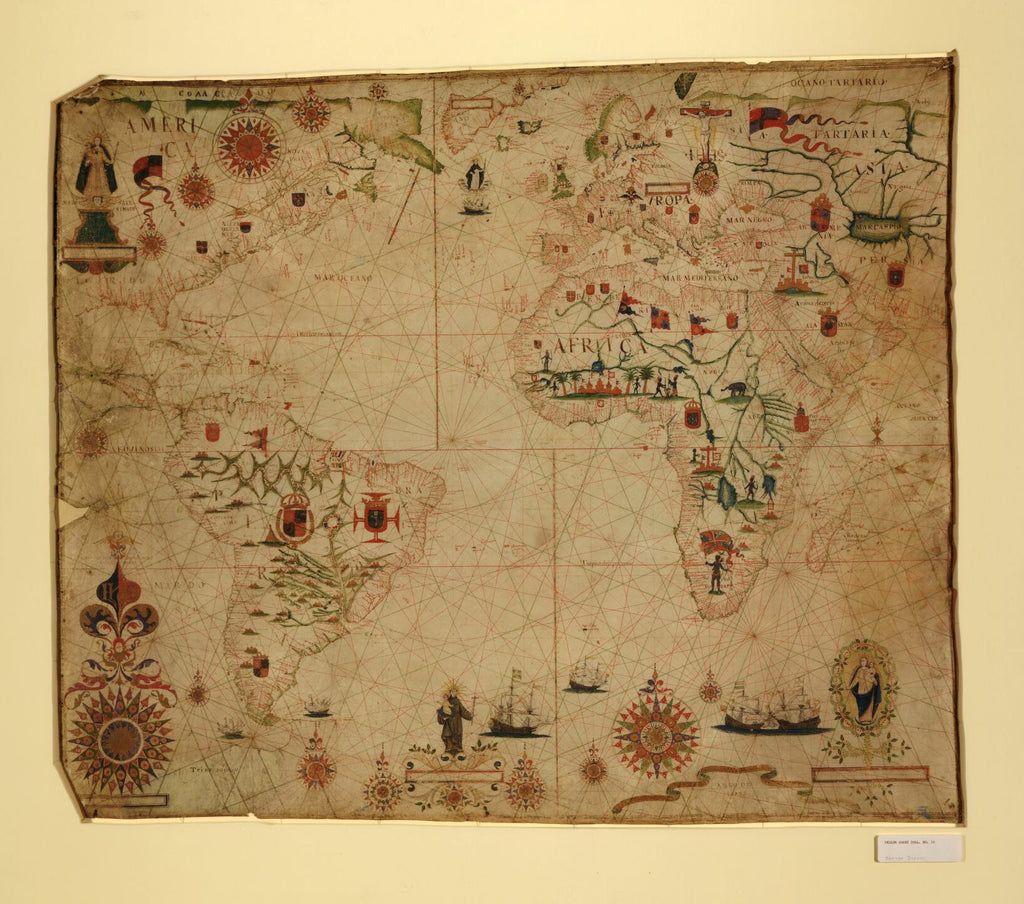
The early mapping of Africa, particularly its interior, can be characterized as an evolution, an ever-changing mosaic based on the general working historical knowledge of the region available at the time to cartographers. This collection of 17th century Africa maps, featuring the works of cartographers, Pascoal Roiz-A Portolan Chart of the Atlantic Ocean and Adjacent Continents, Jodocus Hondius-Africae Nova Tabula, Arnoldo di Arnoldi-Africa and Fredrik de Wit- Totius Africæ Accuratissima Tabula, offers a glimpse of the European view of early Africa, although European exploration of the continent was limited even up to the 17th centuries. These four cartographers mapped the continent of Africa, sharing some similarities and differences in their depiction, but provided their own perspectives of the Africa they thought existed.
Fredrik de Wit was a Dutch cartographer, who was active in Amsterdam during the second half of the 17th and the early 18th centuries, where he created his own publishing shop and became known for his Dutch town maps, along with his most famous work, Nova Totius Terrarum Orbis Tabula. Arnoldi was a Flemish cartographer and the leading engraver and mapmaker in Italy during the early part of the 17th century, who created a set of maps of the four continents as they were known at the time. Pascoal Roiz was a Portuguese cartographer and portolan maker who was active during the 17th century. Jodocus Hondius was a prominent Flemish geographer and engraver who helped to make Amsterdam the center of cartographic publishing during the 17th century. How does their work relate?
All four maps hint at European colonial exploitation or exploration of Africa, evident in the depictions of sail ships along the coast. In fact, European powers established trading posts along the African coastline, from Senegambia to Angola, during their quest to explore and colonize the New World. Pascoal’s portolan chart stands out in depicting colonial powers in the region with various flags and insignia. This exploration on the coast led explorers, sailors, cartographers and traders to record and share their observations, and with this information, helped to shaped Africa cartographically. Still, much was presumed about Africa’s interior because it was not penetrated by Europeans until centuries later. A recurring theme, notable in di Arnoldi, de Wit and Hondius’ maps, is the geographic detail of Africa's interior, the most notable and consistent feature being the Nile River, illustrating its source and its course, which were based on geographer Claudius Ptolemy’s theory, but mapped in the wrong place. There is also a medieval quality in each map, featuring images that have no geographical value, such as sea creatures, buildings and people, but that adds to the maps’ aesthetic appeal, and hints at what explorers encountered or thought existed in the unknown.
These four maps, with all their flaws, served a purpose- helping to shape what the world came to know as the continent of Africa. They were a part of the foundation, inspiring later cartographers to improve upon what they had created. This collection has a place in cartographic history, and rightly so.
To study and order them individually click the following links:
https://great-river-arts.myshopify.com/products/educational-map-series-portolan-chart-of-africa
https://great-river-arts.myshopify.com/products/educational-map-series-africae-nova
https://great-river-arts.myshopify.com/products/educational-map-series-africae-accuratissima
https://great-river-arts.myshopify.com/products/educational-map-series-africa
To view our collection of maps ready to be custom painted for you please click here: https://great-river-arts.myshopify.com/products/archived-africa-maps-1
We Also Recommend