Educational Map Series: Historic Hawaii Collection
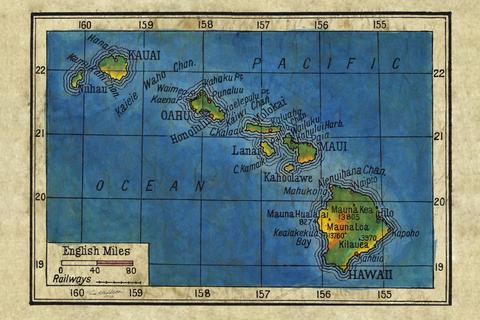
Hawaii has a rich history and culture shaped by an enduring heritage, struggle and its natural environment. Cartography has helped to convey important aspects of the Hawaiian story, particularly as it relates to politics. Before the Kingdom of Hawaii became a territory in 1900, it had enjoyed sovereignty through monarchical rule for some 100 years. Foreign discovery during the 18th and 19th centuries brought about not only considerable, but fast changes that would reshape the Hawaiian archipelago. The politics and economy of the region were typically intertwined during that time and these four maps -Na mokupuni O Hawaii Nei, Topographical map of the Hawaiian Islands, Map of the Hawaiian Islands, Hawaii, 1906- Bartholomew of Edinburgh- help to give an idea of how cartography was used as a political tool and a way to convey changes that the region was experiencing before and after annexation.
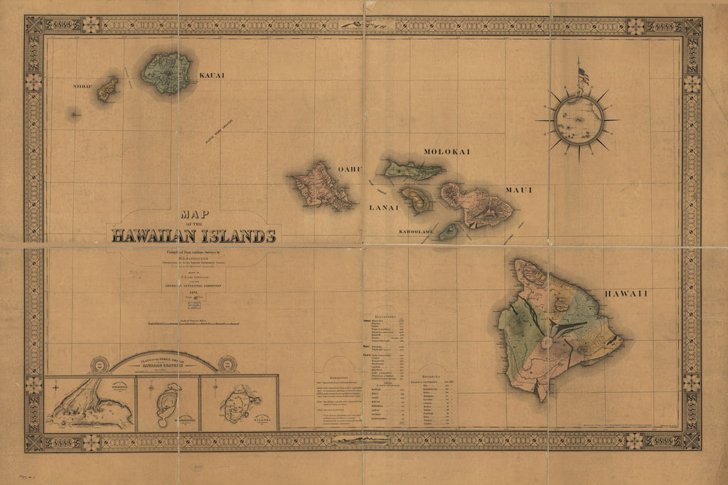
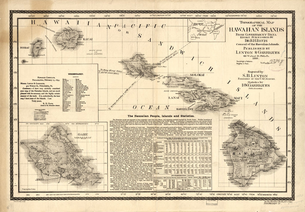
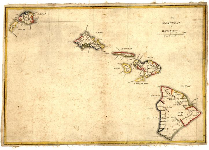
Simona P. Kalama’s map, “Na mokupuni O Hawaii Nei,” published in 1837 is the first separate map of the Hawaiian Islands published in Hawaii. It shows the eight main Hawaiian Islands and highlights three volcanoes on the Big Island-Mauna Loa, Mauna Kea and Hualalai. Map of the Hawaiian Islands was created and published in 1876 for the celebration of the 100th anniversary of American independence by J. L. Smith Co. and is regarded as the first major map published by the Hawaiian Government Survey. Linton and Garrigues’ Topographical map of the Hawaiian Islands” was published in 1893 and was compiled from data derived from Hawaiian Government Survey. It was issued in strong support for annexation of Hawaii. The map, Hawaii, 1906, by John Bartholomew of Edinburgh, Scotland, depicts the Hawaiian Islands as the focal point in the Pacific Ocean.
These maps as a collection makes a political statement about the Hawaiian Islands’ position and power in the Pacific, and perhaps offer a depiction of their presence in a global context. Each individual piece adds to the Hawaiian story, giving a glimpse of what the contributors, cartographers and even publisher wished to present to the public about the Hawaiian Islands struggle for identity. These maps also offer interesting topographical information that helps to define the Hawaiian region. On a whole, all four maps have an important place in Hawaii’s cartographic history.
Order a collection of all of our beloved Hawaii maps on this link or separately here:
https://great-river-arts.myshopify.com/products/map-of-the-hawaiian-islands
https://great-river-arts.myshopify.com/products/topographical-map-of-the-hawaiian-islands
See all of our Hawaii maps here:
https://great-river-arts.myshopify.com/search?type=product&q=hawaii
We Also Recommend