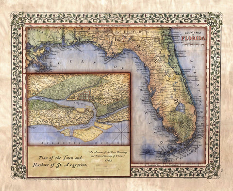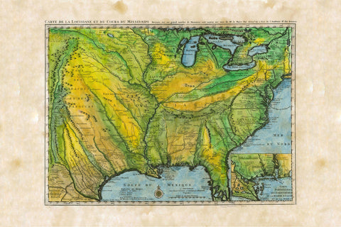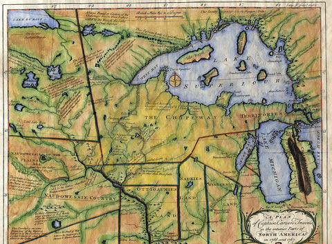
Educational Map Series: The Portolian Collection
The 13th century witnessed advancements in exploration with the emergence of the Portolan chart. While a certain amount of mystery surrounds the origin of these charts, cartographic historians broadly maintain that portolans came about as a result of combining the learned culture of the Byzantines and Arabs with the knowledge oThe 13th century witnessed advancements in exploration with the emergence of the Portolan chart. While a certain amount of mystery surrounds the origin of these charts, cartographic historians broadly maintain that portolans came about as a result of combining the learned culture of the Byzantines and Arabs with the knowledge of medieval European sailors who were making new discoveries. Portolan charts, unlike earlier medieval mappa mundis that were largely religious in their schematic design and purpose, enabled sailors to accurately establish new navigational routes, something that had not been accomplished before.
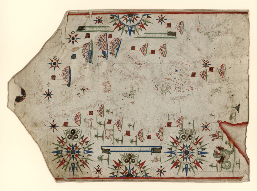
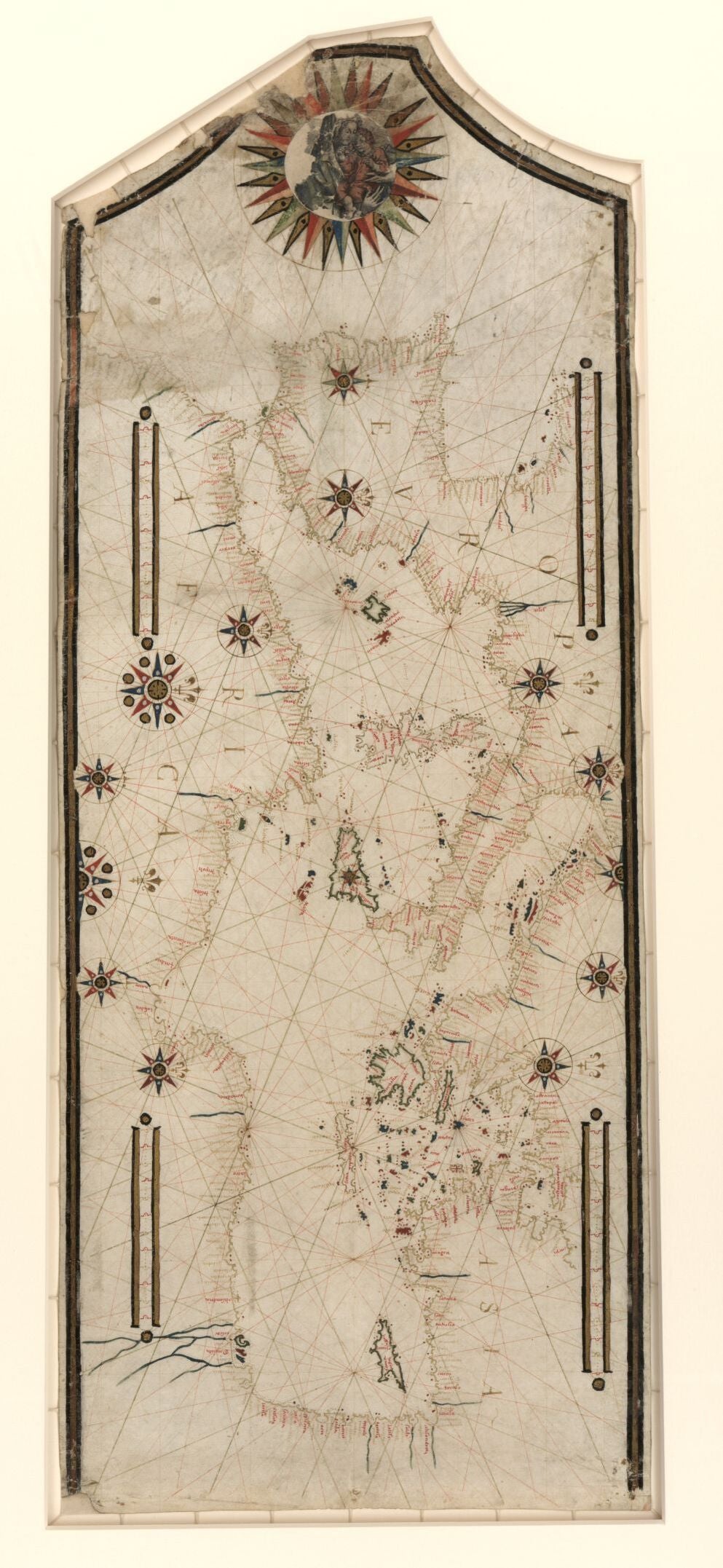
The term portolan is derived from the Italian word ‘portolano’, which means a written description of ports/harbors along a coastline. The oldest portolan chart is the Carta Pisana, which dates from the late 13th Century. Portolan charts are based on directional observation and the personal experiences or observations of sailors and are functional in design. These charts feature a system of rhumb lines that radiates from compass roses that connect harbors by one of the 32 mariner’s compass wind directions. The first compass rose is said to have appeared on a portolan chart found in the Catalan Atlas that was drawn in 1375 and attributed to the Majorcan Jewish cartographer Abraham Cresques. Portolan charts showed the spatial relationships between ports, and the rhumb lines and compass roses aided sailors in plotting their course from one harbor to another and
Inland features were absent from these charts, place names were labeled perpendicular to the coast and the most prominent ports were highlighted in red ink. Some portolan charts were elaborately designed and beautifully colored, serving not only as a navigational tool, but had a symbol of wealth and status. The desire for voyaging by sea led to the rise in demand for portolan charts and the Portuguese and Spanish were the top powers to produce these charts. Portolan charts were largely produced in small family-owned workshops.
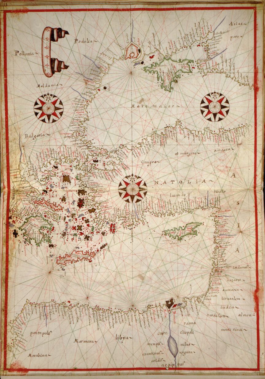
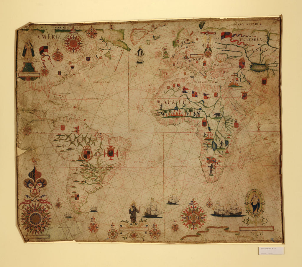
Early charts were meant for navigation along the coasts of the Black Sea and the Mediterranean, and portolan charts are believed to be the first maps to depict the two seas in a form that was recognizable as their true shape. These four charts: Portolan Chart of the Mediterranean and Connecting Seas, Chart of the Mediterranean, Black Sea, and the coasts of western Europe and northwest Africa, Portolan Chart of the Mediterranean and Black Seas with the West Coast of Spain and Portugal and A Portolan Chart of the Atlantic Ocean and Adjacent Continents all offer some insight into the type of detail that was often depicted on these portolan charts, their purpose and the importance of the Mediterranean a crucial hub for commerce.
f medieval European sailors who were making new discoveries. Portolan charts, unlike earlier medieval mappa mundis that were largely religious in their schematic design and purpose, enabled sailors to accurately establish new navigational routes, something that had not been accomplished before.
The term portolan is derived from the Italian word ‘portolano’, which means a written description of ports/harbors along a coastline. The oldest portolan chart is the Carta Pisana, which dates from the late 13th Century. Portolan charts are based on directional observation and the personal experiences or observations of sailors and are functional in design. These charts feature a system of rhumb lines that radiates from compass roses that connect harbors by one of the 32 mariner’s compass wind directions. The first compass rose is said to have appeared on a portolan chart found in the Catalan Atlas that was drawn in 1375 and attributed to the Majorcan Jewish cartographer Abraham Cresques. Portolan charts showed the spatial relationships between ports, and the rhumb lines and compass roses aided sailors in plotting their course from one harbor to another and
Inland features were absent from these charts, place names were labeled perpendicular to the coast and the most prominent ports were highlighted in red ink. Some portolan charts were elaborately designed and beautifully colored, serving not only as a navigational tool, but had a symbol of wealth and status. The desire for voyaging by sea led to the rise in demand for portolan charts and the Portuguese and Spanish were the top powers to produce these charts. Portolan charts were largely produced in small family-owned workshops.
Early charts were meant for navigation along the coasts of the Black Sea and the Mediterranean, and portolan charts are believed to be the first maps to depict the two seas in a form that was recognizable as their true shape. These four charts: Portolan Chart of the Mediterranean and Connecting Seas, Chart of the Mediterranean, Black Sea, and the coasts of western Europe and northwest Africa, Portolan Chart of the Mediterranean and Black Seas with the West Coast of Spain and Portugal and A Portolan Chart of the Atlantic Ocean and Adjacent Continents all offer some insight into the type of detail that was often depicted on these portolan charts, their purpose and the importance of the Mediterranean a crucial hub for commerce.
This collection also includes a bonus 11x17" Piri Reese map!
Also please check out the Portolan maps in our Antarctic map collection!
We Also Recommend