
110 River Longue 1703
Baron de Lahontan....The River Longue
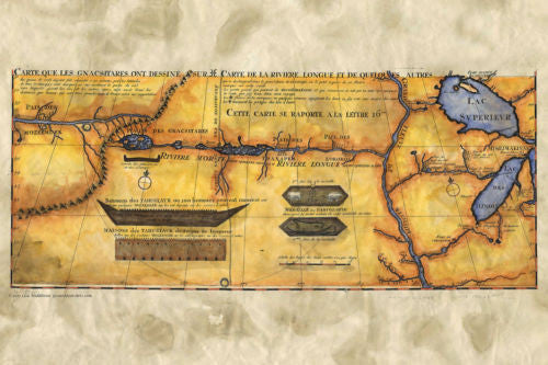
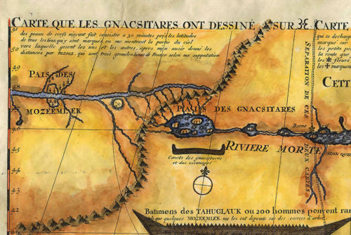
This is a pretty unique cartographic work. It's production perpetuate the myth that lingered for almost 50 years, showing up in other maps that were produced. Baron Lahontan is the mapmaker responsible for the faux pas, but at the time, he imagined his rendering was accurate. The map depicts a river that runs on a west-east directional, finally emptying into a portion of the upper Mississippi River. It was known as the River Long, or Longue in French. You can see the trek that the river makes as it rises distantly over the Rocky mountains in the west, before meeting with the Mississippi. Portions of the Great Lakes are shown as well, including Lake Superior, and Lake Michigan (Lac de Illinois).
The map also features several French forts and outposts that were responsible for fur trading. The French were the first to establish trade with the Indians in this manner. Beaver pelts were used to make hats that were quite popular at the time in Europe. The native Americans were good trappers and developed a symbiotic trading relationship with the early french explorers. The map here gives a snapshot of sorts, of what the trade route would have looked like at the time.
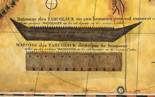
As for the mythical Longue river, it is quite possible that Baron Lahontan used information he collected from the indigenous Gnacsitares Indians. Part of the information seems to be accurate though. If you look closely you will see another river stretching out from the mountains and emptying into the Pacific Ocean. This is thought to be a reference to the Columbia River. The insets feature items of interest that were used by the Tahuglauk Indians. One inset features medals while the other inset showcases vessels. The ironic thing about the information Lahontan gathered from the Tahuglauk and Gnacsitares Indians is regarded to be false because most historians believe these two Indian tribes only existed in his imagination. If that were the case, than most of this map would be completely fictitious in nature.
However, it was considered to be one of the most ornate works at the time, by one of the most influential cartographers of the day. It is no wonder that the Longue River myth held on for almost a half-century before more accurate information was gathered.
All sizes are approximate.
We Also Recommend


