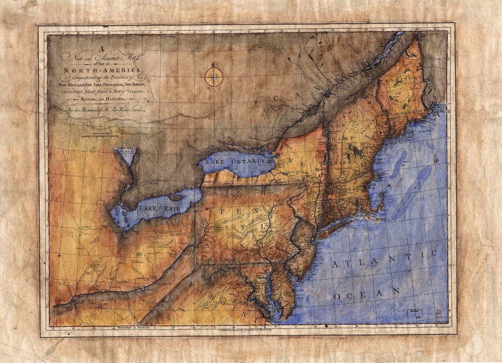
084 New and Accurate Map of Part of North America 1771
This British map features a portion of North America and is described as a “New and Accurate Map”. For its time, it in fact, was. It features parts of New England, New York, Pennsylvania, New Jersey, and few province portions of Canada. At the time it was entered into the English Parliament in the year 1771, these were nothing more than British territories. Great Britain was in the throes of exploration. That can be evidenced by all of the markings made along the eastern coastline regarding cities, ports, and points of interest. Their are also great detailed markings of the river system. River trade routes were vital to the colonists, as well as to British interests. The colonists used the fur routes for establishing trade and exchanging goods and services.
The British wanted it to expand because they received a portion of the revenue that was generated in the form of tariffs, or taxes as we know them today. For several years, they shipped goods to the colonists in hopes of establishing a British presence in the New World. However, unbeknownst to them, in just a few short years, these British colonies would declare themselves sovereign and independent from British rule. This map shows a bit of a precursor to that announcement with its detail in regards to trade locations, outposts, and important cities.
All sizes are approximate.
We Also Recommend


