Mysterious Florida Map
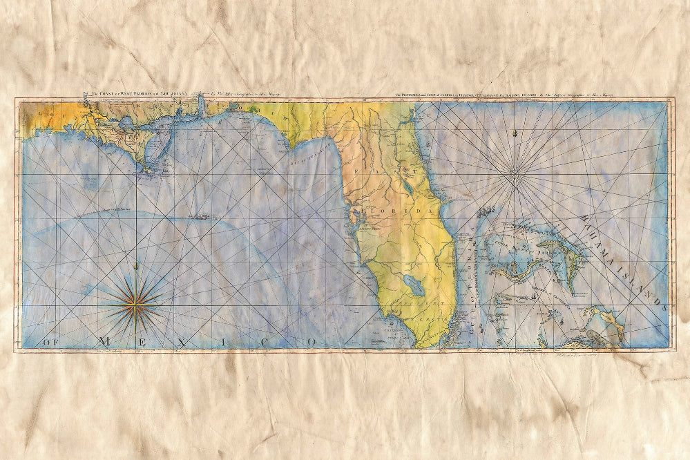
This mysterious 2-sheet continuous Florida map is commonly titled The Coast of West Florida and Louisiana: The Peninsula and Gulf of Florida or Channel of Bahama with the Bahama Islands, a joining of the individual titles listed above the main regions depicted. The map was published in geographer and publisher Thomas Jefferys’ West India Atlas, or, A Compendious Description of the West-Indies: Illustrated with Forty Correct Charts and Maps, Taken from Actual Surveys.
Jeffreys was a successful London map publisher, who was apprenticed to Emanuel Bowen, a prominent English mapmaker and engraver, who was a leading producer of atlases during the 18th century. Jeffreys, in 1748, was appointed geographer to Frederick Price of Wales and, from 1760, to King George III. He is known for producing some of the most significant 18th century maps of the Americas. He is most known today for his maps of North America, his central place in the map trade and for producing maps for several government bodies.
This map, published in 1775, by Robert Sayer in London, is perhaps one of the earliest large format maps available depicting Florida and the Gulf Coast region in such a detailed fashion. There is particular emphasis on sounding/water measurement along the Florida coast, shoals, mangroves, islands and reefs. Rhumb lines are prominent in the map and represents the different wind directions, and which were a common feature of portolan charts that emerged as early as the late 13th century. There is a compass rose in the Gulf of Mexico, and compass rose was often used on maps to gain more precise directional bearings.
The map is also richly embellished with numerous sailing ships, including a fleet in the gulf with the inscription "The Flota's Track from la Vera Cruz to Havanna to avoid the Trade Winds." It stretches west to Louisiana and eastward to comprise much of the Bahama Islands, presenting excellent hydrographic detail of the coastline and the channels. Also depicted are several anchorage points, many early place names, lakes and rivers.
The significance of Jeffreys' mysterious Florida map is perhaps its use as a key source used to create general working charts of the region after it was published. It further served as a guide, identifying the trade routes that were used by the sea powers along the Gulf Coast and through the Bahama Channel, which included the English and Spanish, among other powers.
Final image will be cropped.
We Also Recommend


