Sanibel Island, Sanibel captiva, florida map, florida gifts, sanibel captiva art, coastal decor, beach house, island decor, florida art
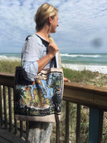
This brand new map of Sanibel Captiva Florida map gift retro art coastal decor for beach house island decor. is bursting with color and fun of the seashell isle! Great for guest rooms, bathrooms, and living rooms, this carefully researched map makes a great gift for travelers and new residents too! Carefully hand colored and printed with the best materials, our maps are known coast to coast for their beautiful colors and fun details!
Located just 30 minutes west of Fort Myers on the Gulf Coast of Florida, the sister islands of Sanibel and Captiva are renowned for their natural beauty, spectacular white sand beaches, breathtaking sunrises and sunsets and exotic shells and wildlife. Both barrier islands are unique in their own right, while having in common rich intrigue and adventure. The story of Sanibel and Captiva Islands goes back to centuries ago, to a period when Native Americans inhabited the islands and Spanish explorer Ponce de Leon first encountered the Calusa Indians in 1513. Other stories give accounts of infamous pirates who sought a safe haven on the islands, and pioneers, fishermen and clergymen who ventured into the wilderness to prospect for a better way of life.
There are different accounts regarding how the islands got their names, some factual and some interesting folklores. The Spanish, in the 1500s, first called the islands Costa de Caracoles, which translates, "Coast of Sea Shells," rightfully so because of the colorful shells that abound on the shoreline of the islands. Some time in the late 1760s, sailors began referring to Sanibel as "Nibel," a Spanish word meaning level because of the seemingly parallel position of the islands to the horizon. A label "S" on a map was later interpreted to mean san or saint, leading to San Nibel, but that name did not stick, and in the mid-1770s, San Nibel was changed to Sanibel by a mapmaker. Captiva is believed to have been mapped by the Spanish for the first time as "Cautivo", meaning "single male captive."
Sanibel is the larger of the two islands and is connected to Fort Myers by the Sanibel Causeway Bridge. Roughly two-thirds of Sanibel have been designated off-limits to development and preserved, featuring spartina grass in the highlands and mangrove swamp in the low areas. With an eclectic mix of nature, wildlife conservation land, and a bounty of rarely seen seashells on its 15-mile shoreline, Sanibel has 22 of miles of paved trails, including the Rabbit Road Trail and Dixie Beach Road.
Most of Captiva is very narrow and it is much more laid-back than Sanibel, with a small and quaint village in the northern part of the island. Its 5 mile of pristine, secluded beaches offers respite from the crowds, incredible opportunity for shelling, while its 700 acres of state land preserve is there for exploration of wildlife and undiscovered treasures.
The charm and character of the islands are much to be desired.
"sizes are approximate"
About Great River Arts: Great River Arts started its journey in 2006 when Lisa Middleton began restoring and painting historical French maps of the Mississippi River. Art collectors and interior designers loved the subtle enchantment of the gently painted maps, and demand for her restored and painted historic maps quickly spread across the country.
Her historical map collection rapidly developed into custom map services for private estates, resorts, lakes, public lands, and regional attractions-all with the vintage charm of Lisa's earlier works, applying borders, cartouches, and fonts found in historic maps from the 1850's and earlier.
Each piece of art created by Lisa is the result of an in-depth, collaborative process between cartographers, architects, colorists and professional researchers. An intrepid traveler, Lisa continues to paint originals and work with her design team from the road and her home base near Glacier National Park, Montana. She pursues new map suggestions and collaborations every day. Please stay updated on Lisa's newest maps and travels at facebook.com/greatriverarts!
*While great care was taken to produce this map, the information was derived from digital databases from various sources. Great River Arts cannot be responsible for errors, omissions, or positional accuracy in our custom map designs other than our intent to provide fascinating information and a delightful memory. Historical maps often contain misspellings and information that might not be accurate. Neither genre should be used for navigation. The user of this map bears full responsibility for his or her safety of person and equipment. There is no warranty, expressed or implied that this map is suitable for an particular purpose. We do appreciate you letting us know of any errors or suggestions at mapart@greatriverarts.com
Let us help you with our unique custom map design services.Full refund if returned in original condition within 14 days. Buyer pays return shipping.
We Also Recommend


