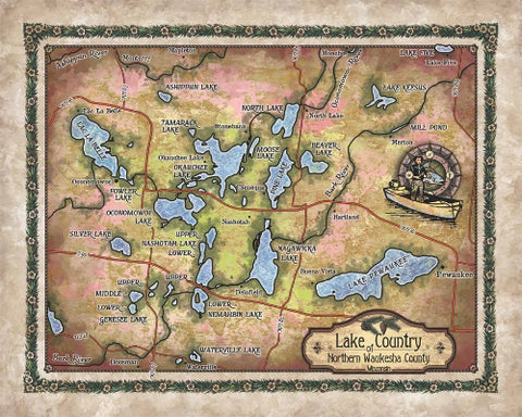
Lake Coeur D'Alene, Coeur D'Alene, Spokane, Idaho Lakes, lake map, lake art, Idaho Gifts, Lake house, custom lake maps, lake gifts, lake map
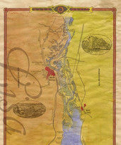
Invite this beautiful Lake Coeur D'Alene Idaho Lake maplake art, Idaho Gift custom lake map into your home!
This new beautiful map was designed by Lisa and her art team, inspired by her love for the area.
Pronounced core-da-lane, Lake Coeur d̢'Alene was formed as a direct result of the ancient Missoula Floods. These floods occurred as an ice dam that helped to form a great glacial lake to the north and east of Lake Coeur d̢'Alene melted at the end of the last ice age. The floods brought great amounts of sediment and boulders into the plains to the south. The sediments and boulders dammed up tributaries which developed into lakes.
When French-Canadian traders and fur trappers came through the area, they encountered the indigenous population which referred to themselves as the Skitwish meaning simply The Discovered People. They began to engage in trades with this tribe and found them to be in their skills and rather cold in their manners as noted by the trader Russ Cox of the Pacific Fur Company which was later sold to the North West Company. Thus, they were known as the Pointed Hearts, or, in French, Coeur d'Alene, which translates as heart of the awl. Though their tribal lands once stretched across the plains of Washington, Idaho, and Montana, an Executive Order by President Ulysses S. Grant established the reservation on which the tribe currently resides.
This name was then given to the lake, the mountains, and the city which grew around the fort built on the lake in the 1870s. The fort was ordered to be built by General Sherman following the Oregon treaty with Britain, giving the United States control of land south of the 49th parallel. The city was incorporated in 1887.
Though the lake is now surrounded by resorts, golf courses, and other tourist attractions, it was once surrounded primarily by lumber mills and mining towns. The lumber industry was a pivotal source of economic development for the area in the early 1900s. Steamboats were used to carry building materials across the lake in the late 1800s and many of the boats did not survive and can still be found on the bottom of the lake. Next to these boats, a diver might also find a Model-T Ford, as many people attempted to drive across the lake in the winter rather than around it. Unfortunately for those drivers, this is not a safe way to travel.
"Due to the unique nature of our maps all sizes are approximate. Please do not purchase a frame until you receive the map and measure it. " Disclaimer: All sizes are approximate. While great care was taken to produce this map, the information was derived from digital databases from various sources. Great River Arts cannot be responsible for errors, omissions, or positional accuracy in our custom map designs other than our intent to provide fascinating information and a delightful memory. Historical maps often contain misspellings and information that might not be accurate. Neither genre should be used for navigation. The user of this map bears full responsibility for his or her safety of person and equipment. There is no warranty, expressed or implied that this map is suitable for an particular purpose. We do appreciate you letting us know of any errors or suggestions at mapart@greatriverarts.com Let us help you with our unique custom map design services.Full refund if returned in original condition within 14 days. Buyer pays return shipping.
We Also Recommend


