118 St. John's River 1876(page 11)
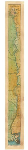
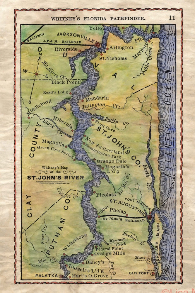
Whitney's Map of the St. John's River
This map of the St. Johns River is part of a work known as ÒWhitney's Florida Pathfinder for the Tourist and Invalid. The guide was produced in 1876 by JP Whitney and was designed to help travelers as they navigated the state during the early years of Florida's development. The guide contained all of the latest commercial routes to Florida that were known at the time, as well as a an excellent drawing of the St. Johns River, like the one on display here. The river is prominently displayed with points of interest noted throughout.
Designed to be informational more so then for aesthetic appeal, Whitney's Map of the St. Johns River highlights the various counties that the river cuts through as it journeys south down the panhandle of Florida. Of note are the various railroads seen in their respective places such as the St. John's Railroad in the lower right-hand corner, and J. P. and M. Railroad pictured in the upper left-hand corner near the vicinity of Jacksonville.
This guide would have made it very easy for anyone to navigate the state via the river and transfer over to Railroad connecting points. This was produced a few decades before we really became an industrialized nation, but you can already see the beginnings of that foundation by taking a quick look at the map.
Again, this was designed to be used on a daily basis. Notice it's minimalist border and lack of detail throughout. The map shows much less in the way of landmarks and points of interest by design. With less to look at, searching the map for destinations and cities was much easier.
All sizes are approximate.
We Also Recommend