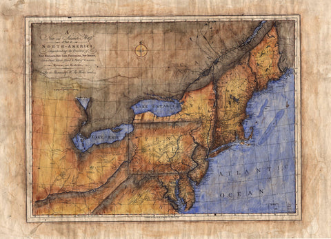
Vermont, Massachusetts Rhode Island and Connecticut 1858
This 1858 map of Vermont, New Hampshire, Massachusetts, Connecticut, and Rhode Island was produced by G. Colton for inclusion in his Illustrated Cabinet Atlas. It was expertly drawn and hand colored, in much the same manner you see here. All of the state capitals are noted and explained in the legend, as well as important places, and towns. Maps of the 1800s would see a new indicator on their map legend as well. Look closely and you will see railroad routes clearly identified through each state.
This was an important means of transportation during the mid-1800s as expansion was pushing west with industry and trade. The east coast would serve as a resource hub until other locales could be established, and production for railroad and mining equipment could be developed. This is why you typically see so many different railway lines down the east coast. Competition was stiff, and there was money to be made if you were a railroad magnate.
All sizes are approximate.
We Also Recommend