029 Coachella Custom Map Designed and Painted by Lisa Middleton
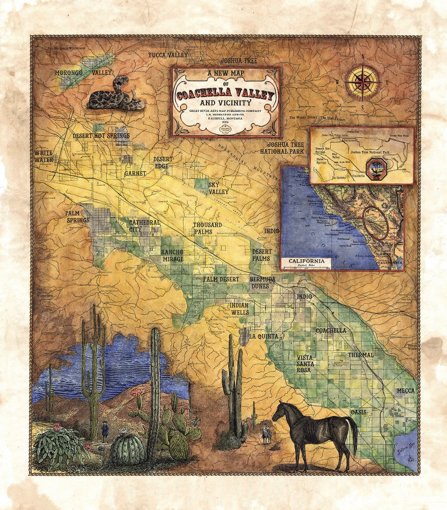
New Map of Coachella Valley
The Coachella Valley has a rich and storied history as it relates to the exploration and expansion of the West. You can see hints of it with this new map of the area by Great River Arts. Prominent towns, cities, and the signature valley grid can be clearly seen. The inset features Joshua Tree National Park, while the other locator inset provides a refernce point for the valley map itself.
For many years, the land was occupied by the Cahuilla native Americans. They occupied many of the canyons located along the south western edge of the valley, near the streams flowing from the San Jacinto Mountains. As exploration began, it was the Spanish who first touched the area naming what we know as Palm Springs, Agua Caliente, or hot water. That name was later transferred over as a local slang moniker to the Cahuilla people.
Industrial change would come to the area in the late 1800s via the United States federal government. In 1876, they divvied up the Coachella Valley by means of checker boarding the land. Odd sections were given to the Southern Pacific Railroad, while even numbered plots were reserved for the Agua Caliente people to use for reservation land. However, it would not be until the early 1940s that official surveys would define the tribal boundaries. By that point, much of what was reserved for the Native American population had already been developed and settled by outsiders.
Towards the south end of the valley, the town of Indio would set off a series of events for the entire Coachella Valley region. The town iteslf, incorporated in 1930, was established as a construction base for railway workers. Eventually, the artesian water would be tapped for crop irrigation. At that point, a turning point of sorts occurred as date palms, imported from Algeria, would take root and ultimately become one of the major crops of the area, along with table grapes, and several varieties of citrus fruits.
The development of the farmland marked the beginning population steady population growth. In time, resorts, hotels, and health spas would pop up, and become very popular with Hollywood stars. What started off as a humble, small ballet tucked into the desert, would become a thriving tourist mecca with glitz, glamour, and a great National Park known as Joshua Tree.
All sizes are approximate.
We Also Recommend


