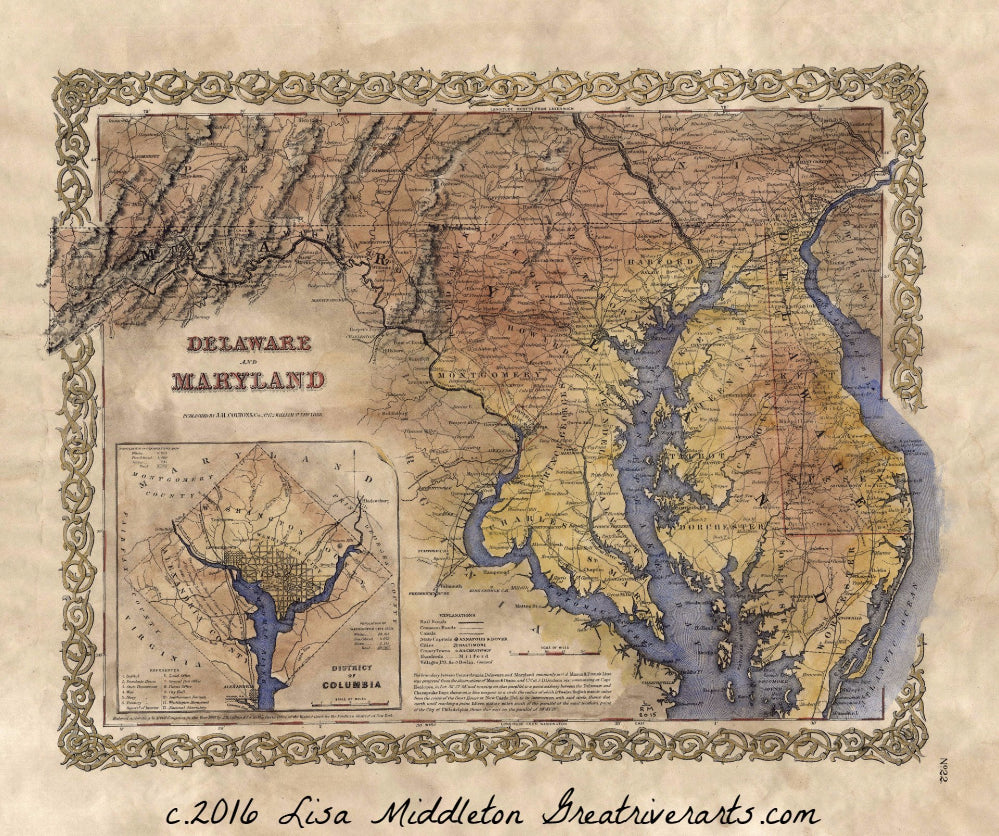
004 1855 Delaware Maryland and Washington D.C.
This map was produced by the famous cartographer J. Colton. This first edition features Delaware and Maryland, with portions of a few adjacent states shown as well. The interesting thing about this map is the fact that it is a derivative work. Colton often used his previous maps as a foundation for newer maps with updated data in regards to boundary lines, typography, and other points of interest.
Notice the inset at the lower left. it features the District of Columbia and has a couple of noteworthy items to mention. First, number 10 makes reference to the location of the Smithsonian Institute. You might be surprised to realize the Smithsonian has been around for so long. Furthermore, number 11 references the Washington monument. Sometimes we forget how old these monuments really are. Maps like this refresh our memory and remind us of the fact that our nation took many years to develop. Earlier maps point to foundational pieces of history. This map is a fine example of that. It also gives great detail of the two river systems that carved through the states. The detail of the rivers should come as no surprise. Rivers had long been mapped in detail as they were the primary means of moving goods and services from one locale to the next. Notice the detail along the Potomac. Every inlet and slew has been carefully and skillfully mapped.
All Sizes are approximate.
We Also Recommend