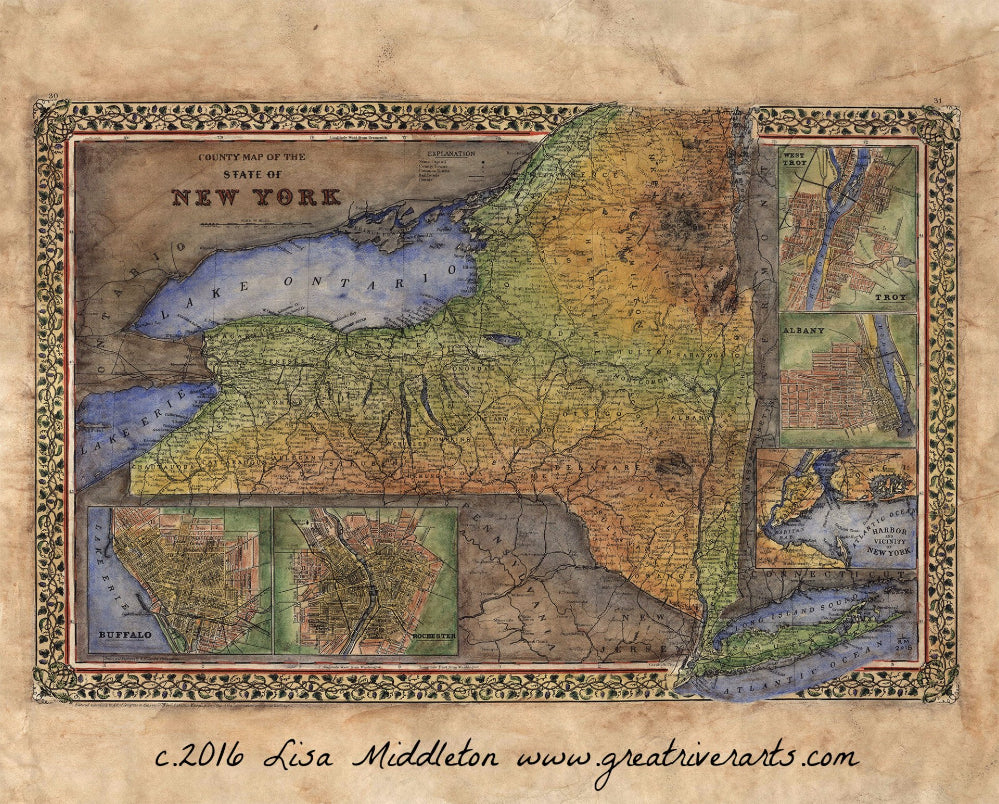
005 1867 County Map of New York State
This county map of the state of New York by Samuel Augustus Mitchell is detailed out to the county level. Special attention is given to geographical features, towns, cities, and proposed railroads. The railroad was a major form of transportation during the time, and as such, new depots and railway lines were always in the works. Additionally, five insets feature city plans for Buffalo, Rochester, New York City, Albany, and Troy. This was a compilation work to be included in the 1867 issue of the new general atlas. As such, the map served as a navigational guide more than anything. It is interesting to get a snapshot look at a young New York State. Many of the towns you see in this map still exist today.
All Sizes are approximate.
We Also Recommend


