Sandwich Islands, Mexico, Central America, Caribbean, West Indies 1878
Mitchel's Map of Mexico, Central America, and the West Indies [Insets of Bermuda, Sandwich Islands, Jamaica and Panama Railroad]
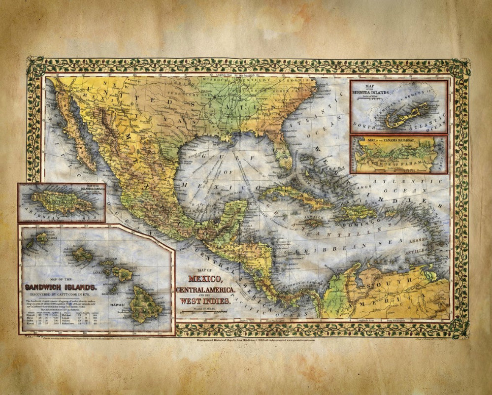
Produced in Philadelphia in the year 1878, this is a hand colored map by renowned cartographer Samuel Augustus Mitchell Junior. This Map of Mexico, Central America, and the West Indies [Insets of Bermuda, Sandwich Islands, Jamaica and Panama Railroads, was created to celebrate the 100th anniversary of Hawaii's discovery.
It was the year 1778 and British Capt. James Cook was attempting to find the Northwest passage thought to be somewhere between Alaska and Asia. Instead, he stumbled upon this small group of islands. He was rather surprised to find something so tropical that far north in the Pacific Ocean and named them the "Sandwich Islands", after the fourth Earl of Sandwich.
The British visit almost cost the islands their entire population by the time the diseases worked their way through the community. Yet in the end they survived and Hawaii is known as one of the most beautiful places in the world so the discovery was not in vain.
This map expertly commemorates that discovery with decorative borders and a few other insets. The insets add interest to the piece and nicely highlight the specific areas as well. Of interest is the table that describes each island of Hawaii. This is a nice touch and a head nod to Cook's original discovery. Attractive and colorful, this map is rare indeed.
*The 16x20" and 11x14 images are available in the pirate style
All sizes are approximate.
We Also Recommend


