063 Key West Florida 1884
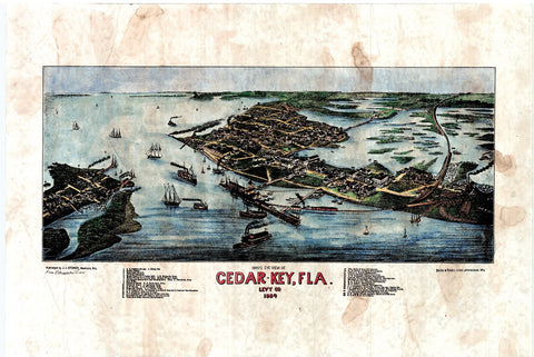
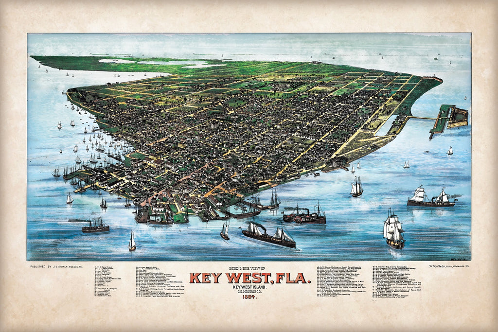
Key West Bird's Eye View 1884
This map depicts Key West the time that is unique in history. Unlike today, you can see that the
population base was close to the busy shipping ports. This was where commerce and industry
happened. It was also where daily life occurred. As such, it was commonplace for towns in the late 1800s to be founded around ports that provided valuable avenues for trade, tourism, and other forms of commerce.
Of note are a few interesting locations on the map. For starters, the famous Duval Street is clearly visible. Yet rather than naming bars and other tourist points of interest along the street, the map lists many general merchandise stores, grocery stores, and shipping supply outfits. It is obvious from this map that Key West was at the height of its days as an islands that catered to maritime trade. By all accounts, it appears that Key West is thriving.
However, one thing would soon happen that would change all of that. If you look closely at the map there is a steam boat towards the bottom right-hand corner. On the boat is the word Morgan. This was a steamship line that ran back-and-forth between the keys and the mainland. It was operated by none other than J.P. Morgan and Company before it was followed up as a subsidiary of a larger firm. This was the only way to get on and off the island at the time. Yet, in the early 1900s, Henry Flagler would revolutionize everything by constructing an oversea railroad that would be used to transport people and supplies to the island.
This would make steamships all but obsolete as a form of tourism, and as such, they would begin to disappear from the tourism landscape. The final cost of the railroad topped out at around $20 million, however it was destroyed with the hurricane of 1935 never to be rebuilt again for one primary reason... the automobile had landed on the scene and was about to change everything.
Yet in the meantime, we get a fantastic snapshot of Key West life as it would have looked in the late 1800s. Many churches and military forts can be located on the map with ease, as well as a host of other places dedicated solely to buying and selling goods to merchantmen, soldiers, ferriers, and the like.
All sizes are approximate.
We Also Recommend