048 Gotha Southwest 1872
Due the the great detail in our Gotha Map collection we only sell these maps as 24x24" and 40x40".
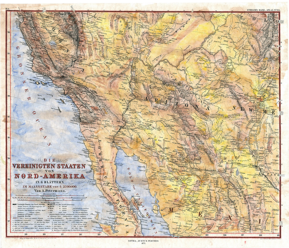
This 1881 map of the southwestern United States by Adolf Stieler is absolutely stunning in its detail. Stieler was regarded for his typography work on maps that he drew. Some of his maps may have been drawn from foundation pieces, but he always made sure to add in the topography as he saw that was an integral part of what a map should indeed showcase.
This map was part of his important Hand Atlas of the World, that was completed in 1823. Ironically and somewhat poetically, all of his other works would be compared to this one by Stieler himself. It seemed that this project was the one he was most fully vested in as a cartographer. The atlas was important as a navigational guide to various territories, states, and countries.
Stieler was known for hand coloring his maps using different shades of color to note different types of boundaries. Some of that is evident in this piece by his use of blue, yellow, and a lighter pastel purple/pink color. The accuracy of the map is astounding. Since Adolf was so detail oriented about topography, it was not until the sixth edition that Stieler's topographical layout needed updating. If you review his maps closely, they can almost appear a bit overwhelming as there is so much information to digest. His maps were known to place as many trade routes and small outpost, or cities in an effort to serve as an adequate guide for navigation. As such, his borders are usually plain. The only ornate detail you might find other then the geographical area and topography of the map, lies in the naming of each map (on this piece it is the lower left-hand corner). Often times, he will use a traditional calligraphy spiral style to enhance the title of the map. Note the spiral detailing near the words ̢‰â?ÒVon Amerika̢‰â?À?. It is ornate, yet still simplistic in its styling, consistent with Stieler's other works.
All sizes are approximate.
We Also Recommend

