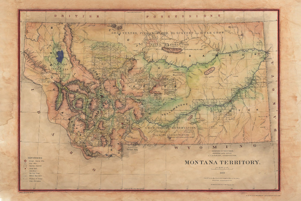
253 Montana Territory 1883 Version 2
This map produced by the General Land Office and shows a picture of the Indian lands that were still present within the Montana Territory during 1883. There is a tendency to forget how long it took to settle the west. The east was settled much earlier as it's shores were discovered first. It took about 100 years after the eats was settled for the west to be fully integrated into what we now know as the United States. Before they were states however, they were territories first as shown by this map.
The map itself was taken from a lithos by noted cartographer Julius Bien. This was a common practice as it saved time and made the process more efficient. Markings on the map are used to notate a few things such as the land office, military reservations, county boundaries, and Indian reservations. Other coloring was used to denote rivers, lakes, and the surveyor general's office.
In addition, you can also see the Pacific Railroad as it cuts through a portion of Missoula. Along the way various stops are noted and it is easy to see how this would become one of the primary arteries for trade and travel throughout the region. The railway had been under construction since it was approved by a congressional act in 1864. Due to that act, almost 40 million acres of land grants were given to raise the necessary money needed for construction. In 1870 the railway was constructed and the mainline begin running from the Great Lakes all the way to the Pacific as soon as Ulysses S Grant drove the final golden spike into Western Montana soil on September 8, 1883.
The Pacific Railway would eventually merge with another railway company several years down the line to become the Burlington Northern Railroad Company. However at the time, the Pacific Railway Company was brand-new. This map showcases a unique glimpse into our nation's history at a time when Indian lands and British territories coexisted alongside U.S. territories and worked in concert together. Eventually, all of that would change as the United States continued expanding and would ultimately become known as the land that stretched ̢from sea to shining sea.
This version is only available in 24x36" and 36x54" Limited edition Giclees.
All sizes are approximate.
We Also Recommend

